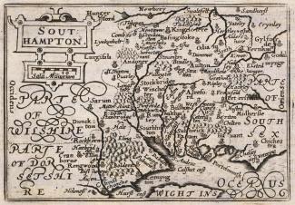
Keere's Map of Hampshire, 1620
A map showing Hampshire, produced by Pieter van den Keere, in 1620. This uncoloured print was published in the 1666 edition of the Atlas. A map by Keere of Surrey is printed onto the reverse.
The scale of the map is about 16.5 statute miles to 1 inch. The Old English Mile used by the map maker is 1.25 statute miles.