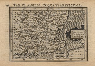
Map, ANGLIAE, IN QUA WARWICUM, 1616
A Map entitled TAB. VI. ANGLIAE, IN QUA WARWICUM &c. Angliae, showing the South East of England, from Hampshire to Kent and as north as Suffolk. The scale is about 45 miles to 1 inch.
This map was engraved by Jodocus Hondius the younger, produced from the Mercator map of 1595, and was published by Petrus Bertius in 1616.