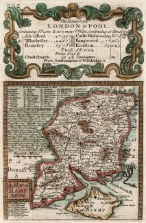
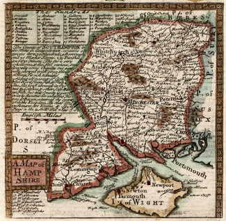
Map of Hampshire 'The Road from London to Pool', 1720
A strip map or road map, taken from a road book entitled Britannia Depicta or Ogilby Improv'd. The text was written by John Owen, the map was produced by Emanuel Bowen, and the book was published by Thomas Bowles in around 1720 onwards. This is part of a two sided sheet.
Page 262 shows a map of the whole county of Hampshire, with the Isle of Wight at a scale of about 11 miles to 1 inch. The map is entitled 'The Road from London to Pool' and lists distances between key towns along the route including Alresford, Winchester, Romsey, Castle Malwood, Ringwood and 'Knaston'.
Page 261 shows Egremont and Cockermouth, to Carlisle, Cumberland.