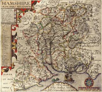
Norden's Map of Hampshire, 1607
A county map of Hampshire entitled ‘Hamshire olim Pars Belgarum’. The scale of this map is about 4 miles to 1 inch. The map was first produced by John Norden in about 1595. This version was engraved by William Hole and published in Britannia, by William Camden in about 1607.