


The Hampshire County Council map collection cared for by Hampshire Cultural Trust consists of over 2000 maps of the county, which date from 1550 to the present day.
There are maps of Hampshire in the wider context, 1550-1600, and early printed maps of the British Isles and Western Europe.
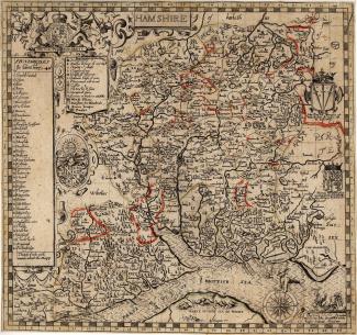
We hold an extensive collection of printed county single and multi-sheet maps from Christopher Saxton to the Ordnance Survey. We also have a large collection of transport and public service maps, for example, maps depicting the growth of the region’s railway network and postal delivery routes.
The collection also contains coastal and navigational charts, and a small number of historic maps of the Hampshire coastal region. Although the collection does contain some manuscript and survey material, it is mainly concerned with printed material.
We are planning to add maps from the collection to our searchable online catalogue in due course. However, a catalogue of the maps in our collection can be viewed through this external link at Old Hampshire Mapped.